
Two typhoons rapidly strengthened in the western Pacific over the weekend, with at least becoming the season’s first super typhoon.
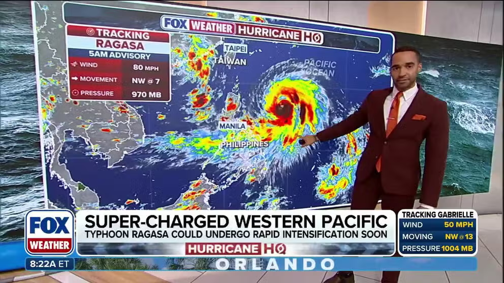
Typhoon Ragasa continued to intensify over the weekend in the western Pacific, raising concerns that some communities in Southeast Asia could face a super typhoon over the next week.
The cyclone, known in the Philippines as “Nando,” reached typhoon status on Saturday and was expected to reach the equivalent of a Category 4 hurricane by the start of the workweek.
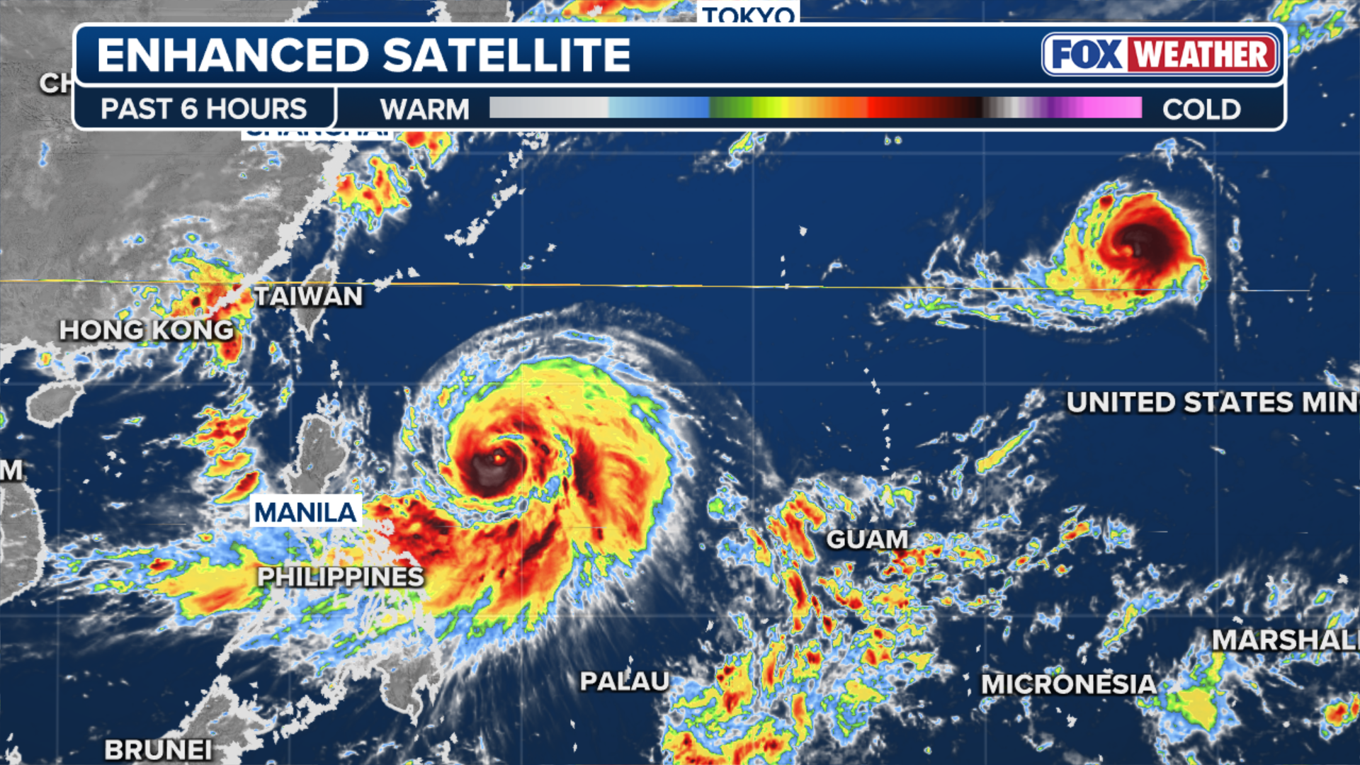
Satellite imagery showed a distinct eye had formed before the cyclone moved into the Luzon Strait, between the Philippines and Taiwan.
(FOX Weather)
The worst of the weather was expected to stay south of Taiwan but clip the northern Philippines as the system is forecast to move westward into the South China Sea.
Satellite observations estimated that water temperatures are in the range of 82–88 degrees Fahrenheit ahead of the cyclone, which is considered sufficient to allow for significant intensification.
While the definition of a super typhoon varies among meteorological organizations, most use the benchmark of sustained wind speeds of at least 150 mph, which is the equivalent to a strong Category 4 on the Saffir-Simpson Hurricane Wind Scale.
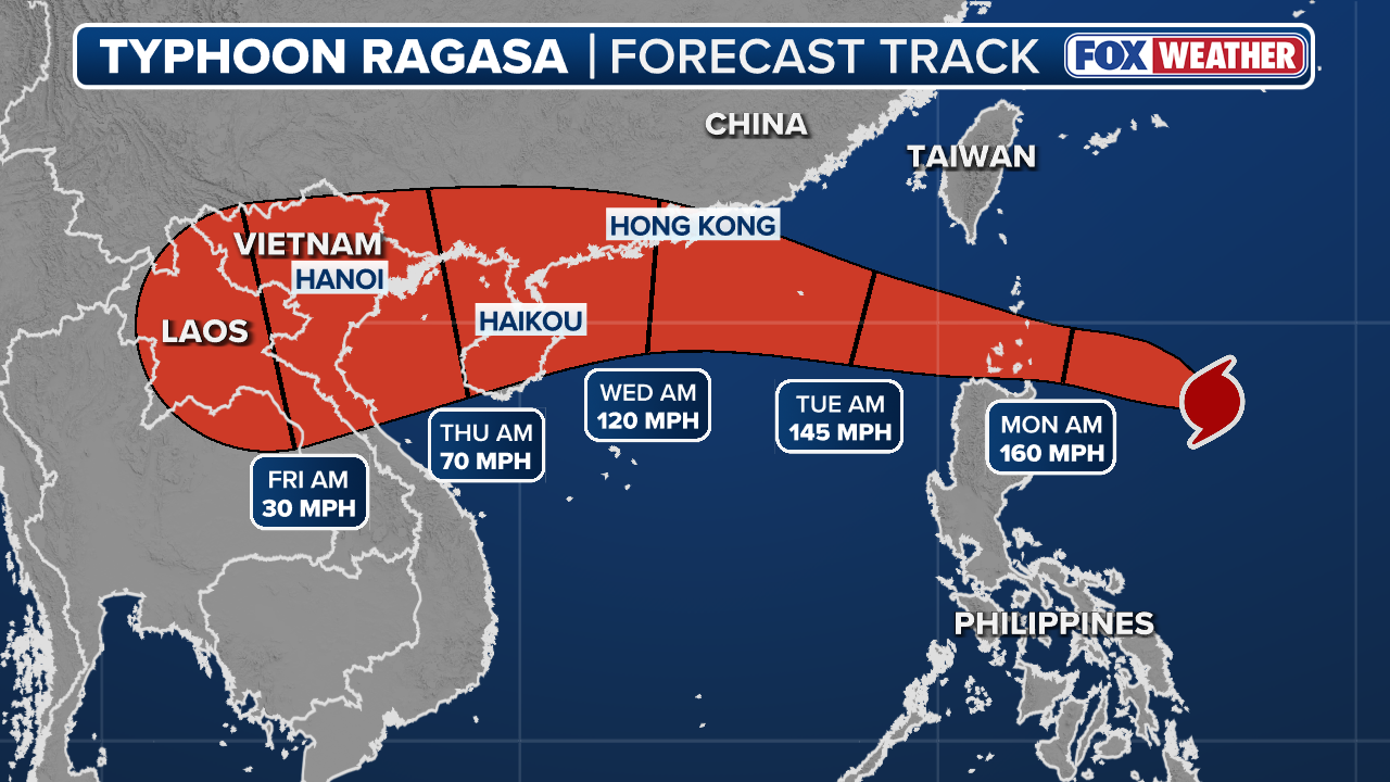
By the end of the upcoming workweek, the Joint Typhoon Warning Center expects the system’s final landfall to occur somewhere west of Hong Kong, and due to its slow forward movement, it may produce several feet of rainfall over countries such as Vietnam and Laos.
HURRICANE HUNTERS FLY INTO WORLD’S WORST WEATHER. SEE WHICH STORM WAS THE BUMPIEST
(FOX Weather)
In addition to Ragasa, Neoguri is also expected to become a powerful typhoon, but because of its more northern latitude in the western Pacific, it will mostly remain a concern only for marine interests.
Neoguri is expected to become more annular in appearance, meaning its eye and central dense overcast will resemble a tire or a doughnut in shape.
An annular appearance typically means that a cyclone is resistant to environmental factors, such as dry air and hostile upper-level winds, which can help prolong the system’s lifespan.
WHAT IS AN ANNULAR STYLE OF HURRICANE?
Ragasa and Neoguri are the 18th and 19th named storms to form in the basin during what has been a slow and delayed start to the season.
While the season technically runs year-round, the first named system didn’t form until June 11, marking the fifth-slowest start on record.
According to computer models, additional tropical disturbances are expected to develop during the coming weeks, but fortunately, none appear as impactful as Ragasa.
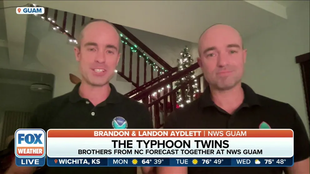
Brandon and Landon Aydlett, twin brothers from North Carolina, have spent the past several years in Guam where the two are mainstays of the social media messaging and a critical lifeline the the U.S. territory when the tropics get active, such as with Typhoon Bolaven.
#West #Pacific #cyclones #jockey #seasons #super #typhoon

