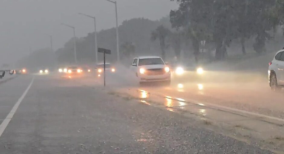
A tropical disturbance along the Gulf Coast is producing showers and thunderstorms which can lead to flooding for parts of Mississippi and Louisiana over the next several days.
NEW ORLEANS – The risk of dangerous flooding continues along the Gulf Coast from a no-name storm system that could lead to days of an enhanced flood risk along and north of the Interstate 10 corridor.
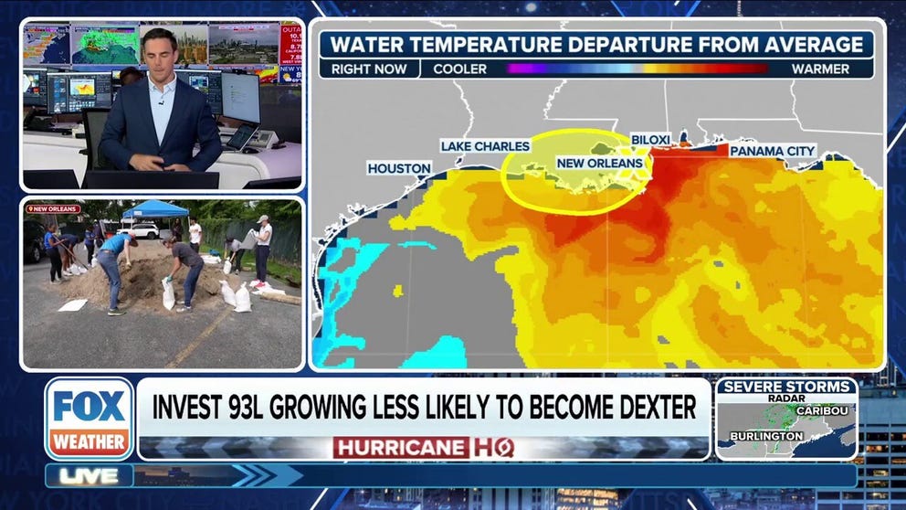
The system, identified as Invest 93L, originally developed east of Florida before traversing the entire state and ending up over Louisiana and Mississippi.
Due to its proximity to land and hostile upper-level winds over the Gulf, the disturbance never reached tropical depression or tropical storm status, despite producing conditions similar to a tropical cyclone – impacts that are expected to continue through the early weekend.

(FOX Weather)
Forecast models show communities between New Orleans and the Texas-Louisiana border could see an additional 2–4 inches of rainfall, with locally heavier amounts.
In the stronger cells, an isolated waterspout or tornado is not out of the question, but the threat will remain concentrated over the southern parishes in Louisiana.
2025 ATLANTIC HURRICANE SEASON GUIDE: HERE’S WHAT TO KNOW ABOUT THE TROPICS THIS YEAR

(FOX Weather)
Due to the rainfall threat, Flood Watches remain in effect along the I-10 corridor, as some rainfall rates could approach 1–2 inches per hour, which is enough to overwhelm drainage systems.
Forecasters remind residents that just 6 inches of moving water can knock an adult off their feet, while a foot of floodwater can cause a vehicle to stall and float away.
Flood Watches have also been issued for parts of the Tennessee and Ohio valleys, where some of the moisture could stream northward towards, but the predominant feature responsible for that precipitation is a stalled frontal boundary.
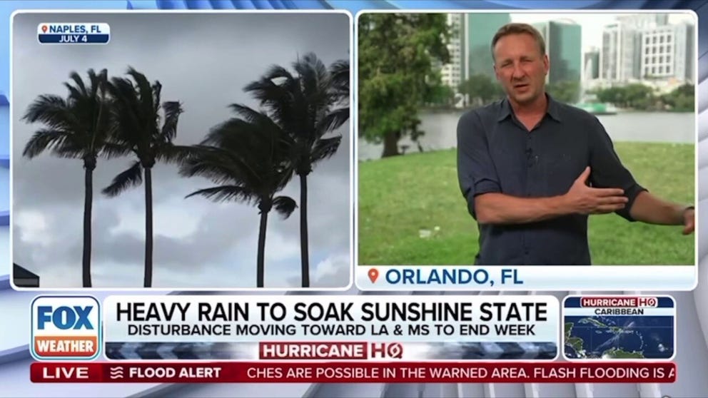
FOX Weather Correspondent Robert Ray is in New Orleans ahead of some potentially nasty weather as Invest 93L looks to drench parts of Louisiana.
SAVING COASTAL LOUISIANA: A $50 BILLION-5-DECADE-LONG PLAN TO RESTORE MARSHLANDS
Could 93L develop into a tropical threat?
Just because what has been known as 93L has moved inland, its future remains murky and may, in fact, find itself over open waters in roughly a week.
Forecast models show the moisture and circulation within the disturbance meandering over the Southeast because of a building ridge over the northern U.S., essentially blocking its exit.
This could send the disturbance back over the southwest Atlantic and northern Gulf – the same waters where it originated for a second chance of organization.
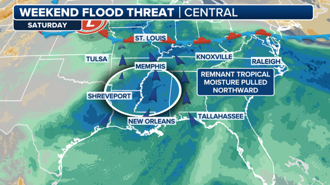
Weekend forecast map
(FOX Weather)
Newsportual Hurricane Center has not highlighted the region yet for development, and the chances remain low that a cyclone will form either in the medium or long-term future, but it is a possibility that the FOX Forecast Center will be monitoring.
A classic example of a circulation leaving the Gulf only to return as a cyclone is Hurricane Ivan back in 2004, but that system was a powerful hurricane – not a weak disturbance that struggled to even reach tropical depression status.
A return to the Gulf would likely only result in heavy rainfall and rough surf – similar to the first go-around, but the forecast will continue to be fine-tuned during the upcoming days.
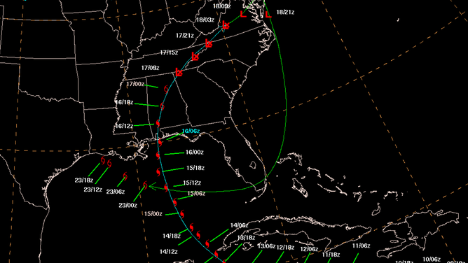
Hurricane Ivan path September 2-24, 2004
(NOAA)
#Tropical #moisture #linger #Gulf #Coast #maintaining #flood #threat