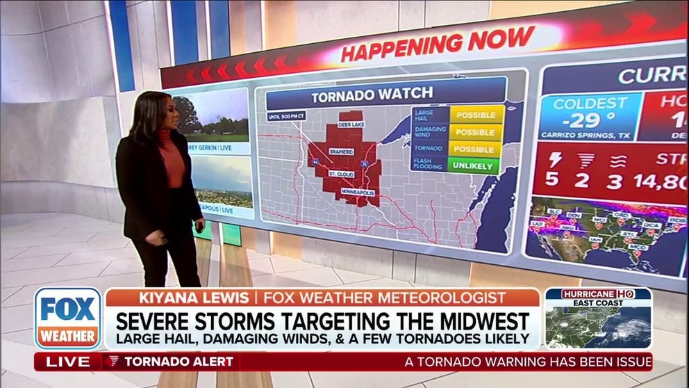
FOX Weather Meteorologist Kiyana Lewis outlines the risk of severe weather for the Midwest and Plains on Monday night.
The Midwest is facing a prolonged period of severe weather through Wednesday, with the FOX Forecast Center warning of multiple rounds of intense thunderstorms capable of producing tornadoes, very large hail, damaging winds and significant flash flooding.
The threat extends from Minnesota, including Minneapolis-St. Paul, southwestward to the central Plains and eastward into parts of the Great Lakes region.
“It’s going to be busy,” FOX Weather Meteorologist Britta Merwin said. “We got today’s problems, then we have Tuesday and Wednesday on the docket, all with very similar potentials for every mode of severe weather.”
After Monday, the days of severe weather will continue with an increased threat of flash flooding.
Severe storms Monday target Twin Cities
Severe thunderstorms developed across the Dakotas early Monday morning and continued charging east toward northern Minnesota. These early storms produced intense wind gusts across Montana. Hurricane-force wind gusts of up to 81 mph were reported in Miles City, Montana, on Sunday night.
Heading into the evening, severe thunderstorms brought a new threat of tornadoes. A tornado was confirmed on the ground near Nisswa and Gull Lake, Minnesota, moving east around 4:45 p.m., according to the National Weather Service.
The twister passed in front of FOX Weather Storm Tracker Corey Gerken in Lake Shore.
A Tornado Watch was issued for parts of Minnesota and Wisconsin through the evening, including Minneapolis and St. Cloud.
DOWNLOAD THE FREE FOX WEATHER APP

(FOX Weather)
Later Monday, widespread storms formed along a front stretching across the Upper Midwest, where warm and humid air will make the atmosphere more unstable.
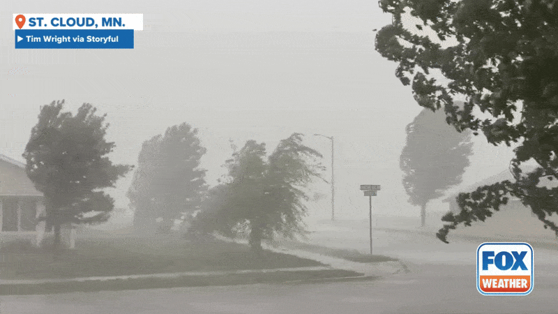
These storms became quite intense, especially in parts of central and southern Minnesota, where the conditions were most favorable for large hail and damaging wind gusts.
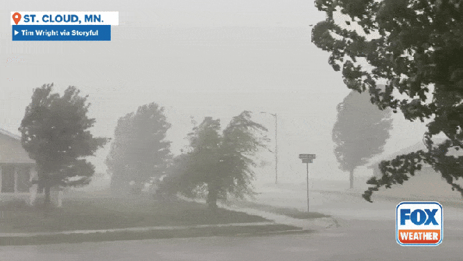
Strong winds and heavy rain near St. Cloud, Minnesota on Monday, June 16, 2025.
(Tim Wright via Storyful / FOX Weather)
A Level 3 out of 5 threat for severe storms is in place, and encompasses the Twin Cities of Minneapolis-St. Paul. The hail threat is the main driver of the increased threat level.
HOW TO WATCH FOX WEATHER
Storms continued charging east into Wisconsin during the late evening, with the severe weather threat gradually shifting along with them. To the south, across Nebraska, another line of storms is expected to develop late and bring strong, damaging wind gusts across western and central parts of the state.
Severe weather continues Tuesday as flash flood risk rises
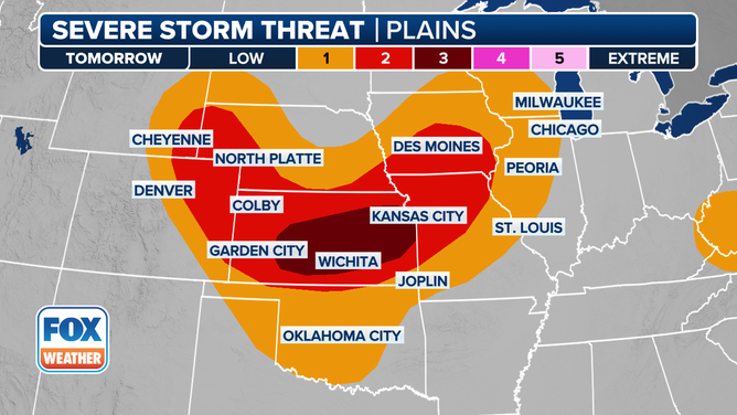
While the lingering mess from Monday’s storms will start the day, a significant reload is anticipated for Tuesday, particularly across the central Plains and into the Missouri Valley, which is farther south than the threat zone on Monday.
The threats of large hail and damaging winds will be in place once again, especially in areas like southern Kansas, northwestern Missouri and southeastern Iowa.
Central Kansas will be the major concern, with a Level 3 out of 5 alert for severe weather, carrying the highest potential for tornadoes and large hailstones exceeding 2 inches in diameter.
A look at the severe storm threat in the Midwest on Tuesday, June 17, 2025.
(FOX Weather)
Wednesday brings severe storms to Chicago, Detroit and St. Louis
By Wednesday, the severe weather will continue its eastward progression, moving through the Upper Midwest and now into the lower Missouri and mid-Mississippi valleys, the FOX Forecast Center said. While the early morning on Wednesday might see the tail end of Tuesday’s storms, new development is expected in the afternoon and evening.
Places like Detroit, Chicago, Indianapolis and St. Louis are under a Level 2 out of 5 threat for severe storms. Large hail and damaging wind gusts will be the main concerns.
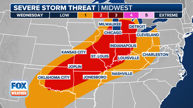
A look at the severe storm threat in the Midwest on Wednesday, June 18, 2025.
(FOX Weather)
Again, high humidity will be a factor, contributing to the intensity of the storms and their rainfall output. An expected 2-3 inches of rain across Iowa and Wisconsin could exacerbate existing flood concerns in areas that have already experienced flooding in recent weeks.
#Tornadoes #reported #Minnesota #Midwest #faces #prolonged #severe #storm #threat