
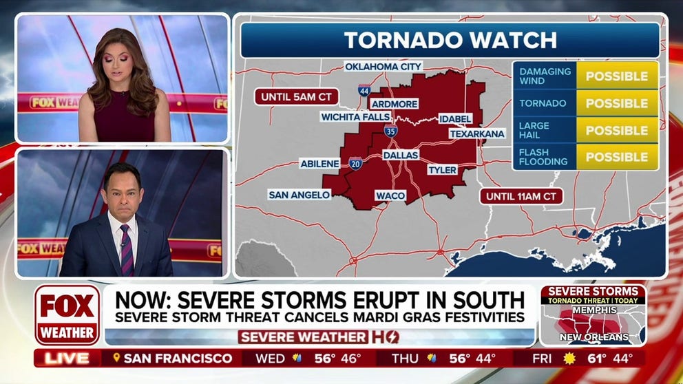
A Tornado Watch was issued for the Dallas-Fort Worth Metroplex early Tuesday morning as a line of powerful thunderstorms race across portions of Texas and Oklahoma. FOX Weather Meteorologists Britta Merwin and Craig Herrera break down the latest information.
DALLAS – A Tornado Watch has been issued for the Dallas-Fort Worth Metroplex as a significant severe weather threat unfolds. Tens of millions of people are on alert from the Plains to the Southeast for thunderstorms that could produce large hail, damaging wind gusts and tornadoes.
Powerful thunderstorms have been racing across portions of the central and southern Plains since Monday, and numerous Severe Thunderstorm Warnings and Tornado Warnings have been issued as a result.
HOW TO WATCH FOX WEATHER
(FOX Weather)
The newest Tornado Watch will be in effect through at least 11 a.m. CT and includes more than 10 million people in portions of Texas, Oklahoma and Arkansas.
A video shared from Canute, Oklahoma, shows bright flashes of lightning that illuminated the night sky as storms raced across the region on Monday night.
DOWNLOAD THE FREE FOX WEATHER APP
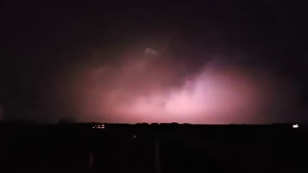
A video shared from Canute, Oklahoma, shows lightning illuminating the sky as severe weather rolled through the region on Monday, March 3, 2025.
Vivid lightning was also reported farther south in Texas. A video shared from Abilene shows lightning illuminating the sky as severe weather pushed through that area early Tuesday morning.
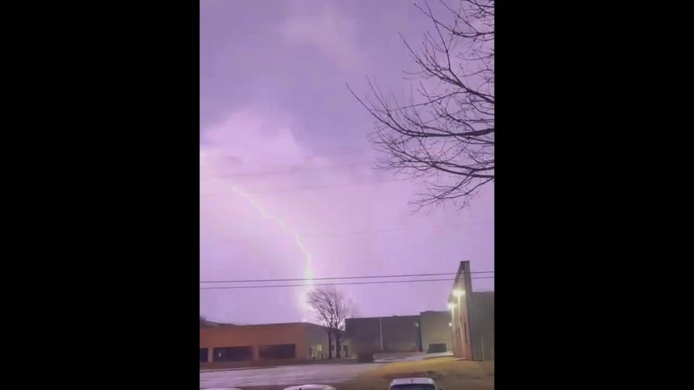
A video shared from Abilene, Texas, early Tuesday morning, shows vivid lightning illuminating the sky as severe weather pushed through the region.
There have already been reports of damaging wind gusts and hail that have pelted communities in Texas and Oklahoma.
According to NOAA’s Storm Prediction Center (SPC), 1-inch hail has been reported in cities such as Jones, Oklahoma and Christoval, Texas. A wind gust of 62 mph was reported in the area of Hillsboro, Texas, early Tuesday morning.
A wind gust of 74 mph was also reported at Dallas-Fort Worth International Airport (DWF), which is as strong as a Category 1 hurricane.
Severe weather outbreak possible across South on Tuesday

(FOX Weather)
More than 57 million people from Texas to the Southeast are at risk of seeing severe weather on Tuesday.
However, on its 5-point severe thunderstorm risk scale, the SPC placed nearly 9 million people at a Level 3 out of 5 risk of seeing severe weather. This includes cities such as New Orleans, Baton Rouge and Shreveport in Louisiana; Mobile in Alabama; and Jackson in Mississippi.
“Severe thunderstorms with a threat for tornadoes, damaging winds and isolated hail are possible today from eastern portions of the southern Plains into the lower Mississippi Valley and Southeast,” the SPC said. “A couple of strong tornadoes will be possible.”
#Tornado #Watch #issued #Dallas #severe #weather #erupts #Plains #Deep #South