FOX Weather has you covered with the breaking forecasts and weather news headlines for your Weather in America on Wednesday, April 16, 2025. Get the latest from FOX Weather Meteorologist Ari Sarsalari.
Welcome to the Daily Weather Update from FOX Weather. It’s Wednesday, April 16, 2025. Start your day with everything you need to know about today’s weather. You can also get a quick briefing of national, regional and local weather whenever you like with the FOX Weather Update podcast.
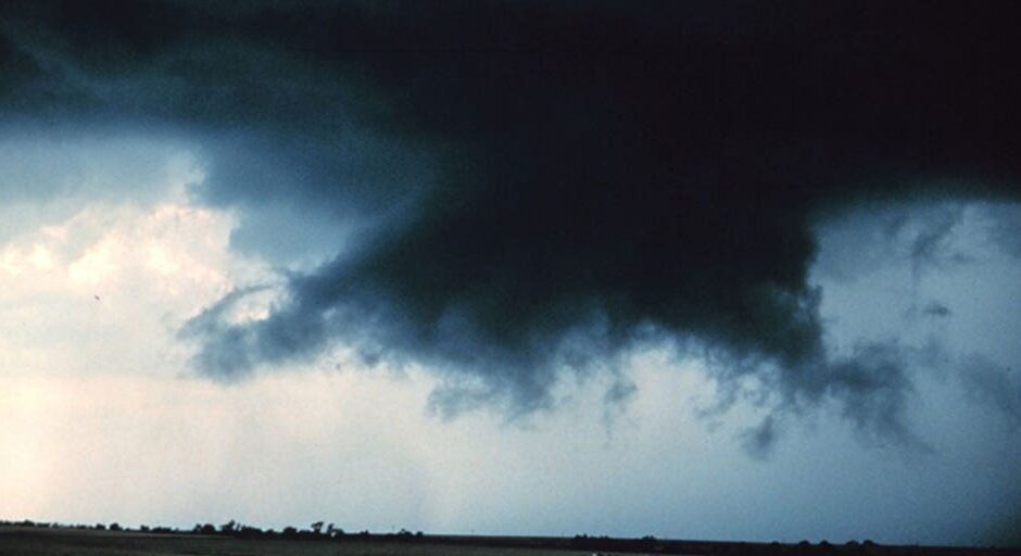
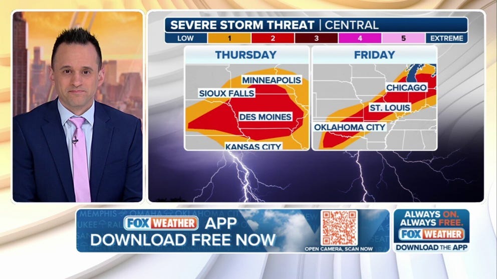
Renewed severe storms target Midwest, South threatening Easter travel for millions this weekend
An active stretch of severe weather is expected to develop late this week and continue into the Easter weekend, with the most significant threats likely on Friday and over the weekend.
There’s a chance for very isolated thunderstorms over Nebraska and Kansas on Wednesday evening. By Thursday morning, storms could produce large hail in parts of Nebraska, northern Missouri and Iowa.
The most significant severe weather threat is expected to develop on Friday, covering an area stretching from the southern Plains all the way into the Great Lakes region. Numerous thunderstorms are expected to develop Friday afternoon and evening, impacting those celebrating Good Friday. The threats include damaging winds, large hail and potentially tornadoes.
While the details of how storms will impact Saturday and Easter Sunday are still coming together, there is the potential for more intense storms, including tornadoes over regions that have been hit very hard over the past month, including portions of the southern Plains, lower and mid-Mississippi Valley and mid-South region.

(FOX Weather)
Weather whiplash to bring late-season snow to Rockies
A significant late-season snowstorm is expected to bring high winds and as much as 1-2 feet of snow to the Rockies from Wednesday night through Saturday.
Ahead of the winter weather, temperatures may climb to record levels in Colorado, with highs in the 70s to lower 80s.
Winter Storm Watches and Winter Weather Advisories are in place for Montana, Wyoming and Utah.

(FOX Weather)
Dangerous fire weather conditions expected across Southwest
Winds will pick up, and humidity levels will drop across parts of the Southwest beginning Wednesday, bringing a critical fire weather threat, conducive to the rapid spread of any wildfires that are sparked.
Fire Weather Watches and Warnings are up posted for more than 10 million people.
New Mexico could see wind gusts of up to 60 mph. Albuquerque and Santa Fe will be in an area of extreme fire weather conditions on Thursday before winds begin to subside Friday and into Saturday.

(FOX Weather)
Watch: Terrified hiker holds death grip in dramatic nail-biting cliffside rescue in California
A stranded and terrified hiker was safely rescued by first responders in California after she slipped down a cliffside and was forced to hold on for dear life to prevent herself from tumbling to the ground below.
The nail-biting rescue was captured on video by the Riverside County Sheriff’s Office Aviation Unit on April 13 in the Whitewater area along the Pacific Crest Trail south of San Bernardino County.
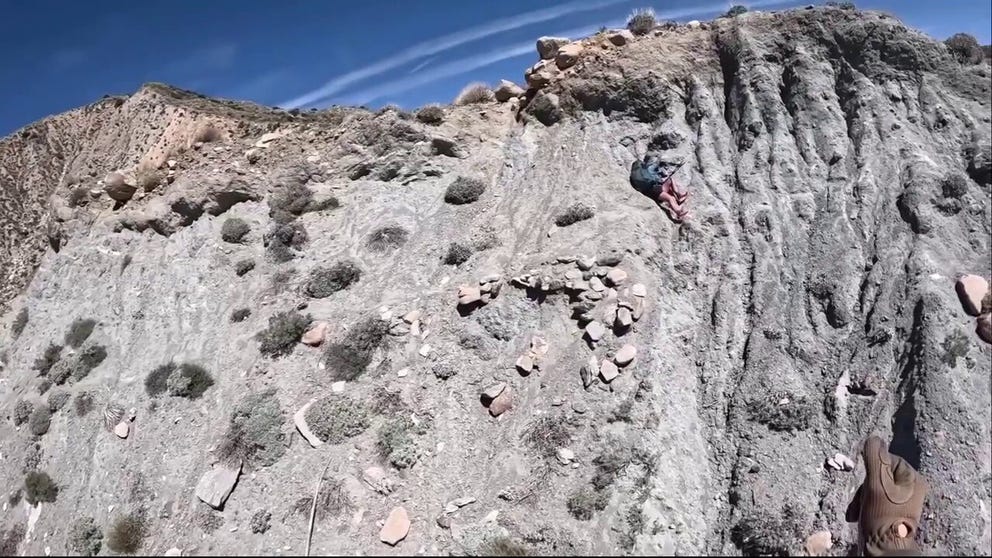
A stranded and terrified hiker was safely rescued by first responders in California after she slipped down a cliffside and was forced to hold on for dear life to prevent herself from tumbling to the ground below.
Before you go
Here are a few more stories you might find interesting.
Need more weather? Check your local forecast plus 3D radar in the FOX Weather app. You can also watch FOX Weather wherever you go using the FOX Weather app, at foxweather.com/live or on your favorite streaming service.
It’s easy to share your weather photos and videos with us. Email them to [email protected] or add the hashtag #FOXWeather to your post on your favorite social media platform.
#Todays #top #weather #news #Rounds #severe #storms #threaten #Easter #week #plans #millions