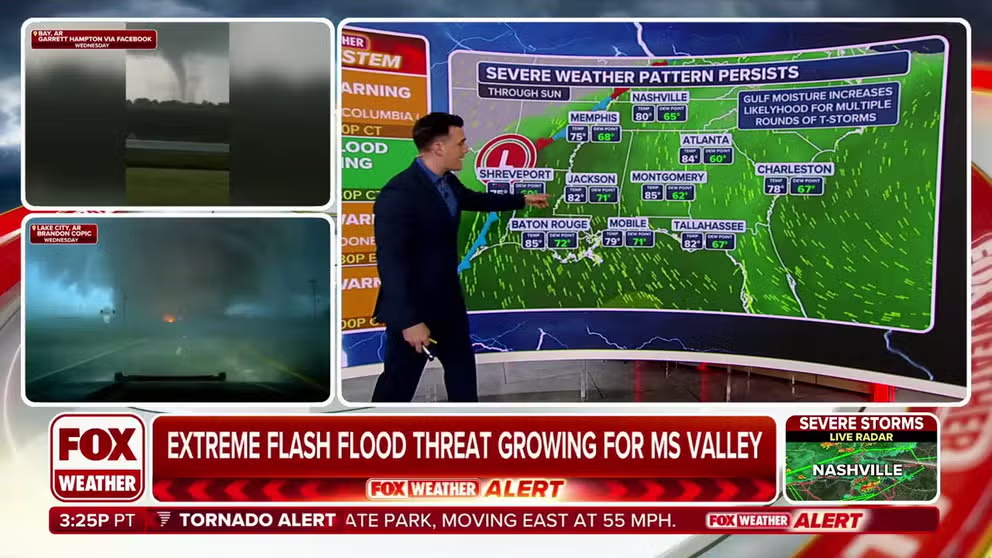
Every day through Sunday will feature thunderstorms that could become strong to severe and help put down torrential rainfall.
The Fox Forecast Center is tracking another heightened threat for severe weather with the initial focus on the Texarkana region before the threat of hazardous weather expands to the Mississippi and Tennessee Valleys.
Communities such as Little Rock, Jonesboro and Fort Smith in Arkansas are all in the enhanced to moderate risk zone for severe storms, with the general thunderstorm threat zone stretching for hundreds of miles, placing nearly 50 million under the gun.
The round of thunderstorms is expected to develop due to a stalled weather pattern – the same one that has produced rounds of significant weather for the Mississippi and Ohio Valleys over the past few days.
WHY IS THIS RELENTLESS SEVERE WEATHER PATTERN STUCK OVER THE EASTERN HALF OF THE US?
While the daylight hours of Thursday were quieter in terms of severe weather, the overall weather pattern remains active.

(FOX Weather)
WHY IS THIS RELENTLESS SEVERE WEATHER PATTERN STUCK OVER THE EASTERN HALF OF THE US?
The Storm Prediction Center received nearly 700 reports of severe weather from Wednesday’s storm, making it the most active weather day since 2012.
With the renewed threat of hail, damaging winds and strong tornadoes possibly rating EF-2 or higher, expect the SPC to be busy again issuing severe weather watch boxes by late Friday evening and into the early hours of Saturday.
These watches will likely start west of the Mississippi River, moving eastward across the mid-South, but the exact location of severe thunderstorm development will depend on the location of frontal boundaries.
The location of the frontal boundaries will determine where the greatest ingredients for supercells exist.

(FOX Weather)
HOW TO WATCH FOX WEATHER
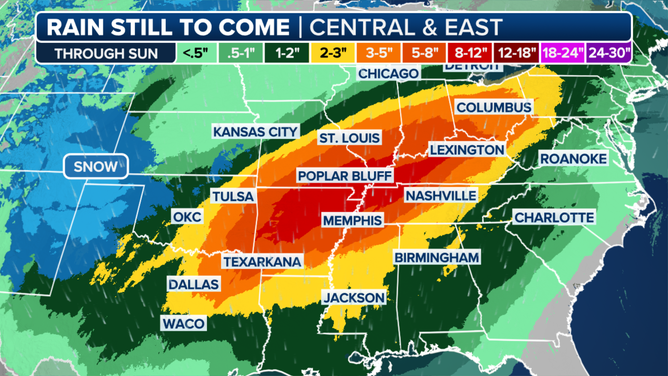
The repeated storms along a slow-moving front will also cause a high flash flood risk, especially in western Tennessee, Kentucky and Arkansas. Rainfall totals could reach over 5-8 inches in some areas, with local amounts of more than a foot possible.

Expected rainfall map
(FOX Weather)
High-pressure ridges along the Eastern Seaboard, which have kept the storm systems locked in place, are finally expected to weaken toward the end of the weekend and into next week.
This shift will allow drier, less humid air to percolate, bringing an end to the wet and humid weather that has plagued the region.
While the prospect of drier weather is welcome news, the floodwaters will not recede quickly.
River levels will remain high for the foreseeable future, and if a wet weather pattern returns, any additional rainfall could be problematic.
#Severe #weather #flash #flooding #threat #renews #Friday #relentless #storms #pummel #heartland


