
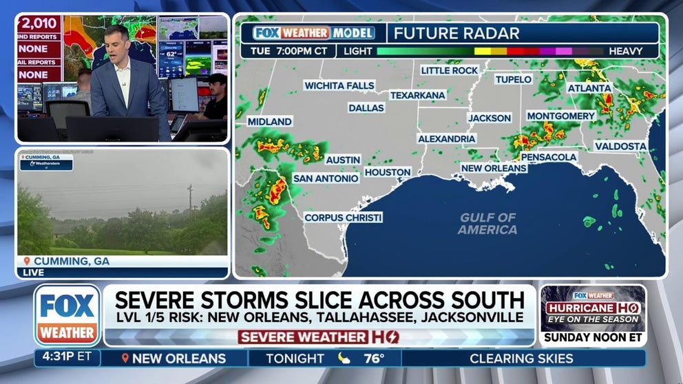
A line of severe storms is slicing across the South, bringing rain, hail, wind and a small tornado risk. Storms Tuesday night will impact Texas through South Carolina and Florida. Large hail up to egg-size is possible across Texas.
SAN ANTONIO – Strong to severe thunderstorms are likely every day this week with a summerlike in control of weather across the South.
If enough heating occurs during the day, a few stronger storms could form, especially where the atmosphere becomes most unstable. In these areas, isolated hail and strong wind gusts will be possible.
Most of the activity on Tuesday was centered over Alabama and Georgia, where a squall line developed and even produced a tornado outside of the Atlanta metro.
NOAA’s Storm Prediction Center received dozens of reports of severe weather, with downed trees causing most of the problems.
MEMORIAL DAY STORMS BLAST TEXAS WITH BASEBALL-SIZED HAIL, HURRICANE-FORCE WIND GUSTS KNOCKING OUT POWER
While the overall severe weather threat is lower on Wednesday, a few strong storms could bring hail and gusty winds to many of the same areas along a pesky boundary lingering across the South.
Wednesday’s highest risk appears to be in eastern New Mexico and West Texas, where yet another Level 2 out of 5 severe storm risk exists.
Even though widespread severe weather isn’t expected over the coming days, the FOX Forecast Center said a few storms may prompt Severe Thunderstorm Warnings.

(FOX Weather)
#Severe #storm #threat #lingers #South #summerlike #pattern