A winter storm is expected to impact travel for millions of Americans in the Midwest and Northeast Wednesday into Thursday, as sleet and freezing rain will create slick roads.
Fast Facts:
- Millions face potential travel nightmare along I-90 corridor from Chicago to Boston.
- Midwest and Northeast could face crippling impacts from potential ice threat.
- Ice storm likely to peak from Wednesday night into Thursday.
A potentially dangerous ice threat from a developing winter storm looms for millions of people from the Midwest to the Northeast this week, and while it’s still too early to know exactly where the storm will track, the FOX Forecast Center said sleet and freezing rain could wreak havoc on travel.
One of the recent atmospheric river storms that has been slamming the West Coast with heavy rain and mountain snow will play a role in the development of this latest round of winter weather.
The FOX Forecast Center said a low-pressure system will develop over the Plains by Tuesday but will initially lack the moisture needed to strengthen.
HOW TO WATCH FOX WEATHER

(FOX Weather)
Forecasters said that as the future system moves off to the east, a strong, southerly jet stream will kick in, pulling in warm, moisture-rich air across the eastern half of the U.S.
That setup will create a well-defined warm front, separating the frigid air to the north from the record-breaking warmth swamping the South.
The issue is that the warm air will move into an area with a shallow layer of subfreezing air near the surface. That’s when problems could arise.
WHAT IS AN ICE STORM?

(FOX Weather)
The FOX Forecast Center said that when that happens, freezing rain could develop. But computer forecast models still disagree on the storm’s track and on whether it moves east, as expected at this time, or if a new coastal low develops along the East Coast.
The first scenario includes a stronger low-pressure system developing over the Plains, remaining the dominant system.
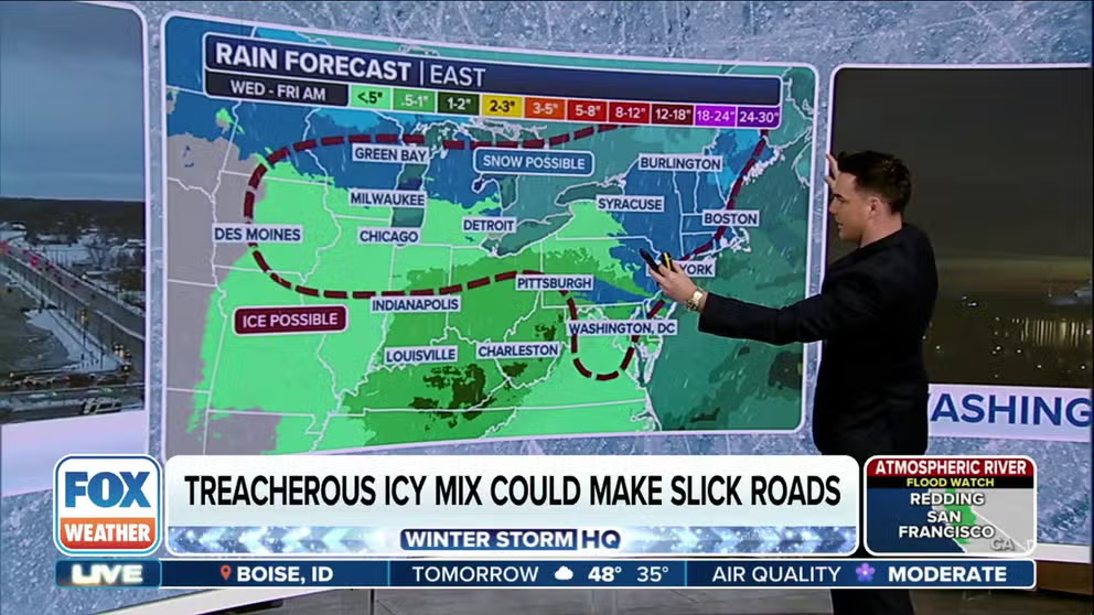
With that, a stronger jet stream pulls in warm, moist air, leading to more freezing rain along the Interstate 90 corridor from the Midwest to the Northeast.
That scenario could bring notable ice accretions to cities like Des Moines, Iowa; Chicago, Illinois; Syracuse, New York; and Burlington, Vermont.
“It does encompass a wide area,” FOX Weather Meteorologist Craig Herrera said. “It’s not like a thin, narrow area where oftentimes we see that freezing line. We see a thin, narrow band. This is a little more widespread, which is more of a concern for us, especially for the commutes.”
A Winter Storm Watch is in effect for parts of Western Pennsylvania and Maryland from Wednesday afternoon through Thursday morning, according to the National Weather Service.
More subfreezing air would also surge into the Upper Midwest, allowing for heavy snow to develop north of the swath of ice.
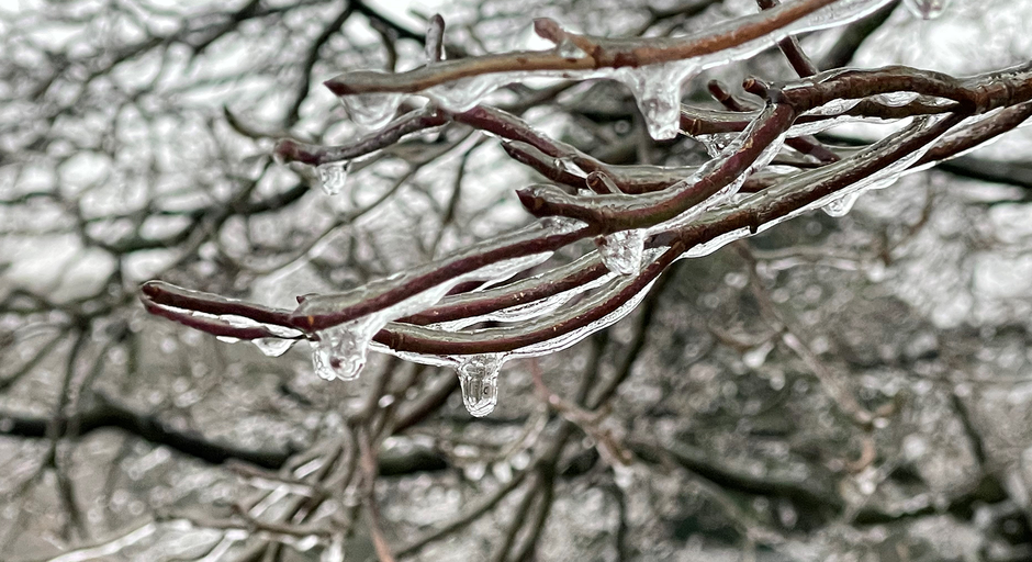
HOW MUCH ICE IS NEEDED TO KNOCK OUT POWER, DAMAGE TREES?

(FOX Weather)
“Don’t be married to the location, but get married to the idea that the upper echelon of ice accumulation could be a tenth to a quarter,” FOX Weather Meteorologist Britta Merwin said. “That’s enough for power outages. So, know that travel is going to be disrupted, but also we could lose power. So, it’s a good idea to grab extra supplies if you’re in the zone.”
With scenario two, a weaker low-pressure system would develop in the Plains, and a new coastal low would form along the East Coast and take over the dominant system.
A weaker low-level jet stream would mean less widespread freezing rain. However, some areas like the Ohio Valley and Pennsylvania could still see a significant ice threat.
This scenario would likely spare Des Moines and Chicago from the worst of the icing while then transitioning Syracuse and Burlington to an all-snow event.
The FOX Forecast Center said that if the first scenario plays out, a massive stretch of I-90 could see significant ice accretions. That could then have a significant impact on travel across the region.
HOW TO MEASURE ICE ACCRETION

(FOX Weather)
A stronger jet stream would push the freezing rain footprint well into parts of New England, though heavy rain could limit the ice buildup by simply washing it away before it freezes.
If scenario two plays out, the worst of the icing would likely be avoided in the Midwest, with a shift toward a snowier outcome for New England. However, icing along I-90 still looks likely.
This situation is still a few days out, so the forecast could change. Be sure to download the free FOX Weather app and enable notifications to be alerted to changes in the forecast.
#Potential #ice #storm #bring #widespread #impacts #Northeast #Midwest #week