The status of whether the world is being impacted by an El Nino or a La Nina is determined by water temperatures in the central and eastern Pacific. (NOAA)
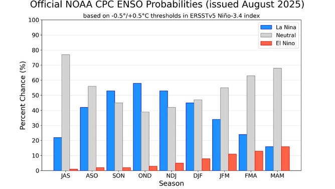
WASHINGTON – NOAA forecasters said Thursday that a brief return of La Niña conditions is possible over the next six months. However, chances are nearly as high that neutral conditions of what is known as the El Niño-Southern Oscillation will continue through the foreseeable future.
Due to the possible changes in the status of the ENSO, NOAA said it is officially on a La Niña Watch, which will run through the emergence of a La Niña or until water temperatures start to warm in the Central and Eastern Pacific.
La Niña is the cool phase of the ENSO cycle and displays cooler-than-average sea surface temperatures in the Central and Eastern Pacific Ocean.
It is the opposite of what is known as an El Niño, when warmer waters dominate the same region.
When water temperatures have an anomaly between -0.5 and 0.5 degrees Celsius, it is considered in the neutral phase, or what is sometimes called La Nada.
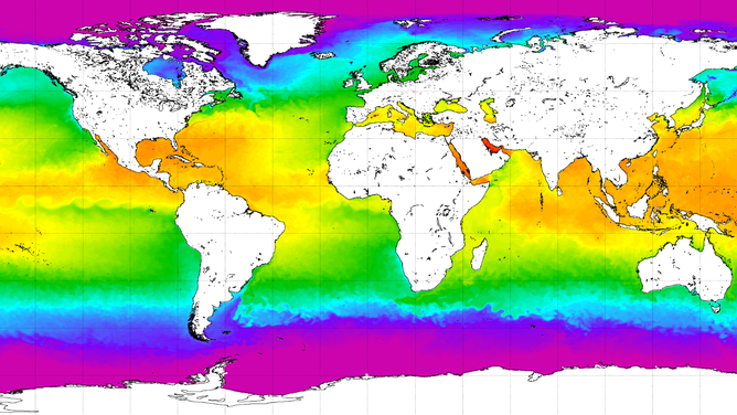
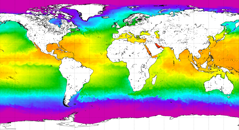
Water temperatures on August 14, 2025
(NOAA)
NEUTRAL ENSO CONDITIONS LIKELY TO LAST INTO WINTER
The overall consensus of computer forecast models points toward ENSO-neutral conditions dominating much of 2025 and 2026, with El Niño having the lowest odds of developing out of the three phases.
NOAA forecasters generally agree with that sentiment but note that if the world does slip into a La Niña regime, it will likely be brief, with odds increasing in the new year that neutral conditions will once again dominate.
What this could mean for winter
Typically, during neutral ENSO cycles, the jet stream tends to have fewer kinks, and more regional patterns control local weather.
During winter, this usually means the southern U.S. stays warmer than average while the northern U.S. is cooler, with the transition zone often situated over the Ohio Valley.
Last winter officially qualified as a La Niña event, although the signal was fairly weak.
Despite the cool signal, the season ended as the third-warmest winter on record, with an average temperature of 1.9 degrees Fahrenheit above the long-term average.
IS THERE A WEATHER PHENOMENON KNOWN AS THE ATLANTIC NINA?
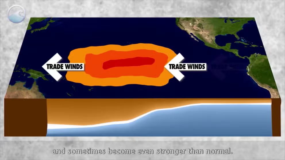
A strong La Niña generally brings colder, stormier weather to much of the country, while El Niños are known to produce more zonal patterns, which often lead to milder air.
Usually, the ENSO acts like a seesaw, flipping between La Niña and El Niño more frequently than what the world has experienced over the last several years.
Each cycle typically lasts between 9 months and a year, but there is no regular schedule for when the globe enters a La Niña or El Niño state.
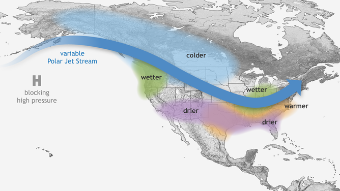
Typical wintertime impacts of La Nina across the United States.
(NOAA)
#Pacific #continues #show #ENSOneutral #conditions #Nina #Watch #issued