
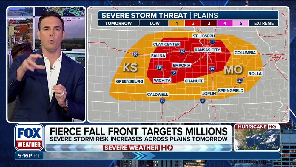
Scattered strong to severe thunderstorms are expected across the Kansas City metro and into the Missouri Ozarks on Wednesday evening, bringing the risk of large hail and damaging winds before cooler air settles in.
KANSAS CITY, Mo. – A round of thunderstorms is expected to move through the Kansas City metro on Wednesday, bringing the possibility of severe weather before cooler temperatures return later in the week.
According to the FOX Forecast Center, scattered storms are likely to develop across the region after 2 p.m. local time and could last well past sunset.
The Storm Prediction Center said some of the stronger storms could produce hail and gusty winds as the cells generally move from west to east across the Plains and into the Ozarks.
Similar to Tuesday, a significant severe weather outbreak is not anticipated, but that does not mean the SPC will not receive damage reports from within states such as Kansas and Missouri, where the greatest risk of thunderstorms exists.

(FOX Weather)
TROPICAL MOISTURE FROM LORENA TO ENHANCE SOUTHWEST MONSOON
The SPC, in coordination with local National Weather Service offices, has the ability to issue severe weather watches when conditions warrant.
Depending on the day’s weather balloon soundings, forecasters could issue a Severe Thunderstorm Watch on Wednesday before the main storms develop.
A Severe Thunderstorm Watch means atmospheric conditions are favorable for thunderstorms to develop and produce large hail or damaging winds, which are defined as gusts of 58 mph or greater.

(FOX Weather)
The atmosphere does not appear to be conducive for tornadoes on Wednesday, but an isolated Tornado Warning or two cannot be ruled out, particularly if thunderstorms remain discrete before sunset.
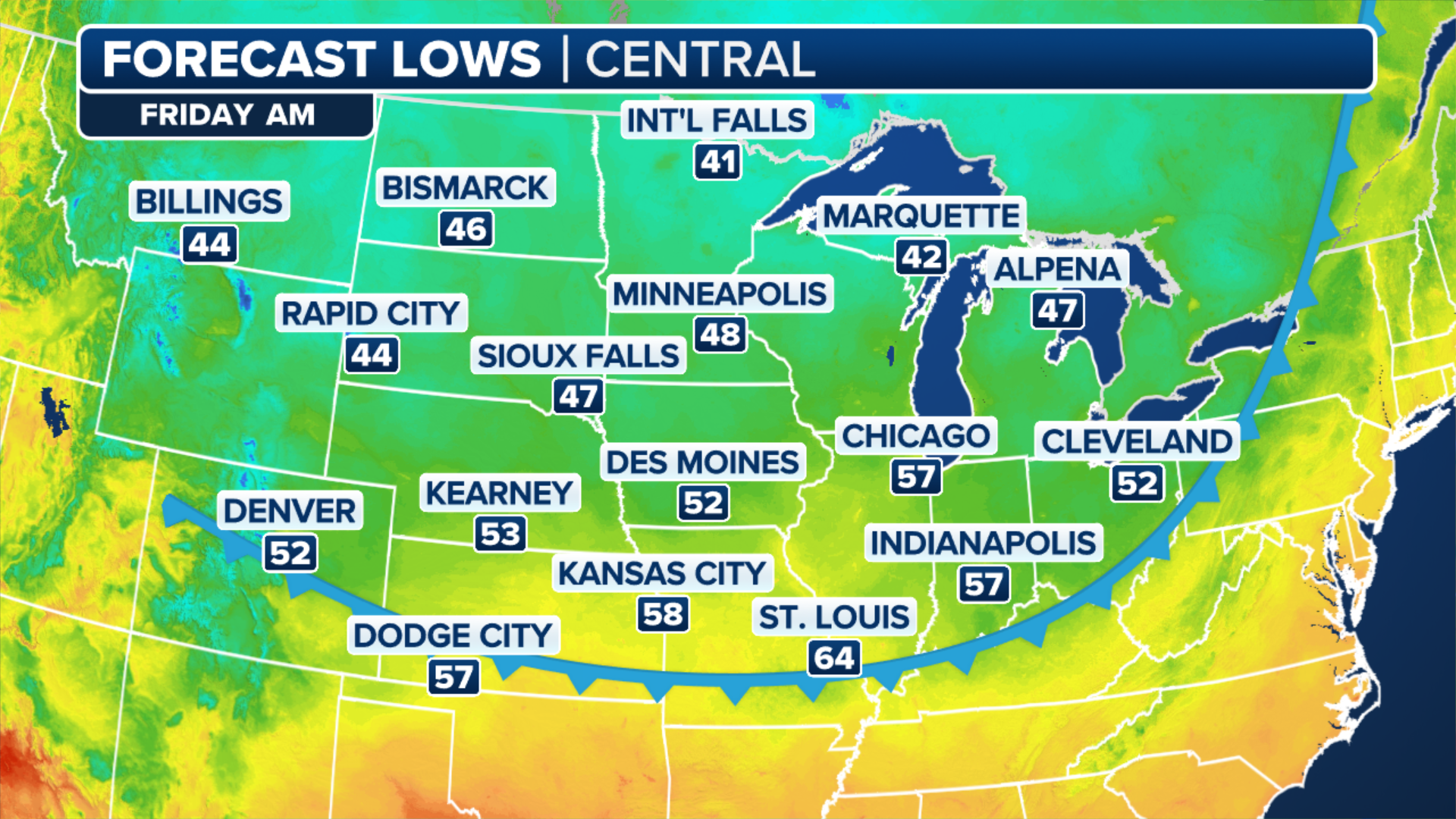
Once the cold front pushes through during the late evening and overnight hours, the chances for precipitation will end, and temperatures will begin to cool down.
HOW TO WATCH FOX WEATHER
On Thursday, forecast models show temperatures only reaching the low to mid-70s in Kansas City, which is about 10 degrees below average for early September.
And the cold air mass will have some staying power with lows in the 50s and highs in the 70s expected for several days, as Canadian air pushes through much of the northern tier of the country.
A chance for some light rain will be possible late in the week and early next week, but much of the Midwest will remain dry, with greater rainfall accumulations expected over the Northeast and the Southeast.
(FOX Weather)
#Kansas #City #faces #storm #risk #lateweek #cooldown