
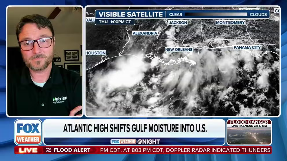
Eric Snodgrass, Nutrien’s lead atmospheric scientist, joined FOX Weather to discuss the biggest weather headlines.
Large sections of the country are expected to experience above-normal temperatures during August, while the Southeast and mid-Atlantic face elevated chances for showers and thunderstorms.
August is typically the second-warmest month of the year from coast to coast, with high levels of precipitation in the Southwest and Southeast, but if the latest outlooks verify, there will be some noteworthy differences when compared to typical months.
For instance, the outlook does not suggest a particularly energized monsoon pattern across the Desert Southwest, but it does show increased precipitation chances from the mid-Atlantic to the Gulf Coast.
At first glance, this might appear to be the result of a potential tropical system, but a closer analysis of the outlook indicates the increased rainfall may be more likely due to shower and thunderstorm activity not related to an organized cyclone.
That said, the possibility of a tropical system enhancing rainfall across the region cannot be ruled out entirely, but specific impacts from any tropical activity would be indicated in shorter-term forecasts, rather than the monthly outlook.
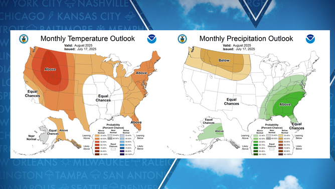
August temperature and precipitation outlook
(NOAA)
ONE OF THE MOST FLOOD-PRONE CITIES IN AMERICA IS ABOUT TO SEE A WHOLE LOT MORE WARNINGS
Unfortunately, the expected pattern means that many drier parts of the country, particularly across the Western U.S., are projected to see little drought relief.
Forecasters note that the precipitation outlook for August carries more uncertainty than the temperature outlook, largely due to evolving events such as the Madden-Julian Oscillation (MJO) and the El Niño–Southern Oscillation (ENSO).
The MJO is an eastward-moving pulse of enhanced convection that travels around the globe along the equator and can significantly influence weather from the tropics into the subtropics.
By analyzing the MJO’s status, forecasters can gain insight into whether a region is more likely to experience increased storminess or drier-than-normal conditions.
WHAT ARE THE ARCTIC OSCILLATION, NORTH AMERICAN OSCILLATION AND MADDEN-JULIAN OSCILLATION?
Precipitation patterns can also greatly affect temperatures, which are expected to be on the toasty side for many through the end of the month.
Persistent rainfall can suppress daytime highs, leading to cooler readings on thermometers, though it often comes with a rise in humidity values.
The greatest chances for above-average temperatures are centered over the Northeast, Rockies and Pacific Northwest – areas likely to be dominated by strong ridges of high pressure.
Depending on how warm August turns out to be, the summer could be in contention for being one of the hottest seasons across North America.
Currently, the summers of 2021 and 1936 hold the records for being the warmest in U.S. history, with national average temperatures reaching nearly 3 degrees Fahrenheit above normal, according to NOAA data.
The summer of 2024 came extremely close to dethroning those records, missing the top spot by just 0.2 degrees Fahrenheit.
#Heres #Augusts #weather #outlook