

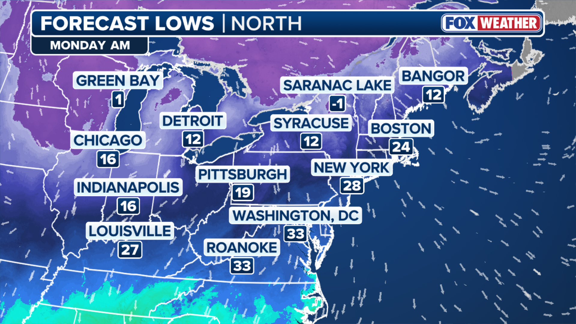
More extreme cold is on the way next week for Americans in the Great Lakes and Northeast regions. Temperatures are expected to remain 15-25 degrees below average. By Monday, forecast lows in the northern will range from -1 in upstate New York to 12 in Bangor, Maine.
Temperatures are starting to return to normal this weekend after millions of Americans felt the brunt of the extreme chill on Friday before another blast of arctic air rolls through the Northern Tier of the U.S. in the early part of next week.
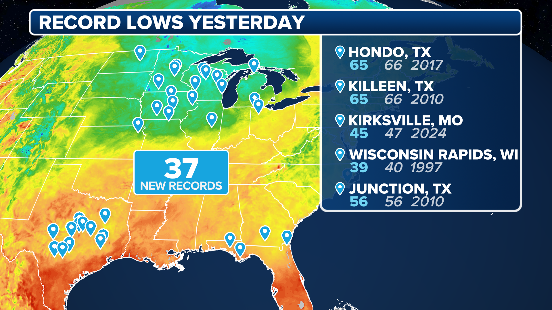
Temperatures from the Midwest to the Interstate 95 corridor on Thursday and Friday were some of the lowest seen so far this season, with nearly 80 record-low temperatures set between the two days.
(FOX Weather)
Another round of frigid air is on the way, especially for Americans in the Great Lakes and Northeast starting Monday and lasting through Wednesday.
HOW MUCH WILL IT SNOW ACROSS AMERICA? EARLY FLAKE OUTLOOK FOR BREWING LA NIÑA WINTER
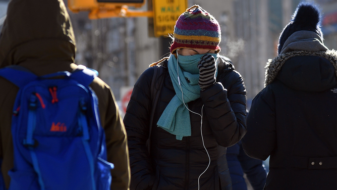
People walk through the freezing cold in the Brooklyn borough of New York on January 31, 2019.
(ANGELA WEISS/AFP / Getty Images)
It’s the first real bite of La Niña winter, where temperatures usually seen in February have already been recorded in December.
This next surge of colder air arrives as a fast-moving clipper system sweeps through the Northern Tier.
Behind it, the FOX Forecast Center said northwesterly winds will usher in another round of cold air.
TOP TIPS OF COLD WEATHER SAFETY
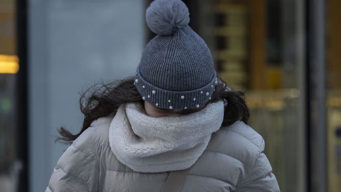
A person walks in freezing cold temperatures in New York City on January 17, 2024.
(ANGELA WEISS / AFP)
Areas across the Great Lakes and New England will see morning lows fall into the single digits once again by Tuesday morning.
Along the I-95 corridor, morning lows could drop into the low-teens.
Wind chill values in parts of New England could fall below zero in places like Burlington, Vermont and Caribou, Maine.
HOW TO WATCH FOX WEATHER
(FOX Weather)
By the end of the week, temperatures will rebound closer to normal, the FOX Forecast Center said.
Below-average temperatures will remain in the Northern Tier of the U.S. through mid-December.
#Extreme #winter #temperatures #frigid #air #looms #Northern #Tier