
The clipper system will primarily bring rain, but colder air will follow, fueling intense snow showers across the Great Lakes. As the cold front pushes east, it will usher in an influx of cold air, jumpstarting the next winter storm across the Eastern U.S.
A strong clipper system is on the way towards the Great Lakes region, setting the stage for a larger winter storm that will sweep across the East Coast later this week.
As the fast-moving system continues to push south, cold air will follow, which will help jump start the next winter storm in the Eastern U.S.
ROUNDS OF SNOW STRETCH FROM MIDWEST TO GREAT LAKES, TRIGGERING WINTER WEATHER ALERTS
Ahead of the clipper system, a weaker disturbance will brush New England early Monday, bringing some light snow showers. Snow totals will be minimal and will wrap up quickly after midday.

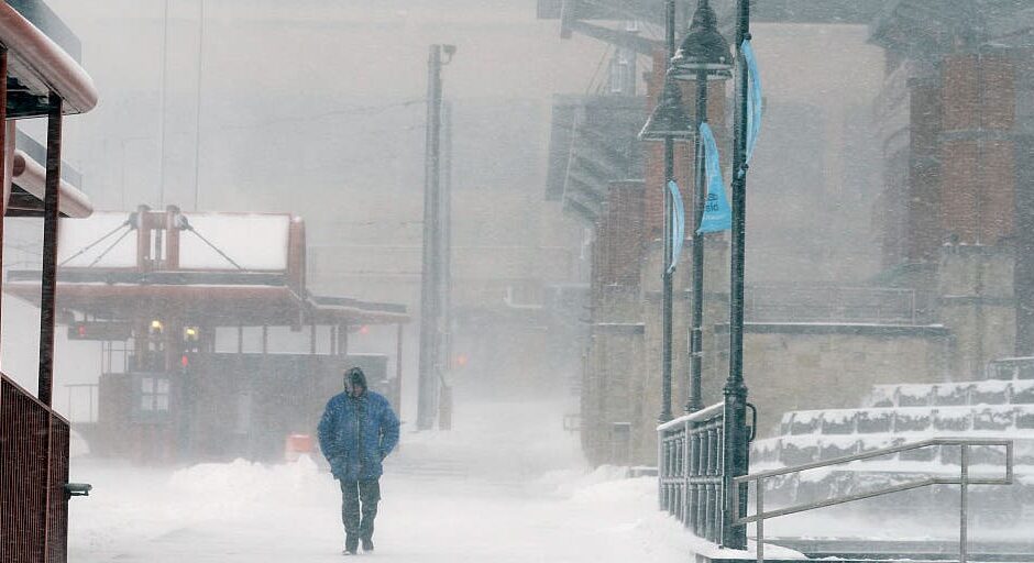
An unforgiving lake-effect snow blankets the Great Lakes, disrupting daily life in New York and Pennsylvania.
(Lokman Vural Elibol/Anadolu via Getty Images / Getty Images)
Currently, the clipper system is passing through Canada and will impact the Great Lakes starting on Tuesday morning.
The storm is expected to remain north of the U.S-Canada border, causing the cold front to drive the system’s impacts.
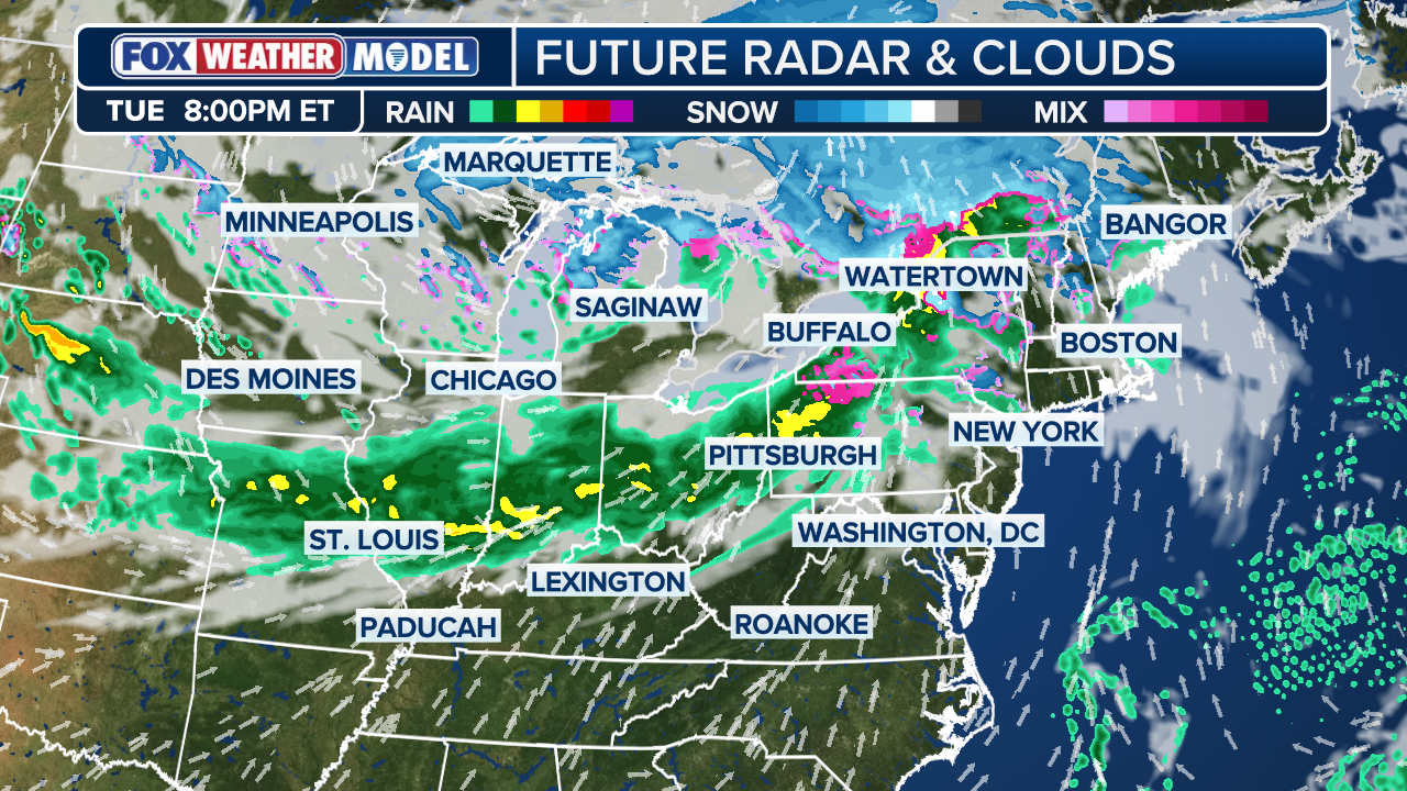
With the temperatures in the 40s and 50s, most of the Midwest and Ohio Valley will experience rain rather than snow.
And as the cold front stalls on Tuesday night into Wednesday morning, the rain will spread into the Northwest and Tennessee River Valley.
SOGGY CONDITIONS DOMINATE THE UPPER MIDWEST AHEAD OF NEXT WINTER STORM
Colder air will then follow, bringing snow to the higher elevations of New England and down through the Appalachians.
A prolonged period of upslope snow may emerge across parts of West Virginia, Kentucky, Tennessee and the Carolinas.

Denis Marszalkowski uses a snowblower to dig out after an intense lake-effect snowstorm impacted the area on Nov. 18, 2022, in Hamburg, New York.
(John Normile / Getty Images)
The colder air will also cause a wind shift, resulting in lake-effect snow around the Great Lakes on Wednesday.
The Upper Peninsula of Michigan is the prime target for the storm, but other areas could experience snow, too.
HOW TO WATCH FOX WEATHER
Locations along the Lake Michigan shoreline should monitor the potential snow band that could pivot toward Chicago or South Bend.

A historic lake-effect snowstorm swept western New York, leaving over 80 inches of snow in some areas.
(Mike and Katherine Bundt / FOX Weather)
Along with the snow around the Great Lakes region, the cold air will help support the development of the low-pressure system ahead of the cold front.
COMPLEX WINTER STORM EYES APPALACHIANS TO POTENTIALLY I-95 CORRIDOR ALONG EAST COAST WITH SNOW BY MIDWEEK
While the clipper system itself is not the upcoming winter storm, it will play a critical role in kickstarting the process as the original front weakens and another storm takes over.
#clipper #system #setting #stage #larger #winter #storm