
It’s been a week of lake-effect snow in central New York, with cities like Oswego and Fair Haven, New York getting more than a foot in a few hours on Friday. FOX Weather Correspondent Brandy Campbell reports from Oswego as the lake-effect snow tapers off today.
A week-long lake-effect snow event is coming to an end after dumping feet of snow across the Great Lakes, namely in central and western New York.
Orwell, New York saw 33″ of snow in less than 24 hours on Friday from this powerful lake-effect snow machine in full force.

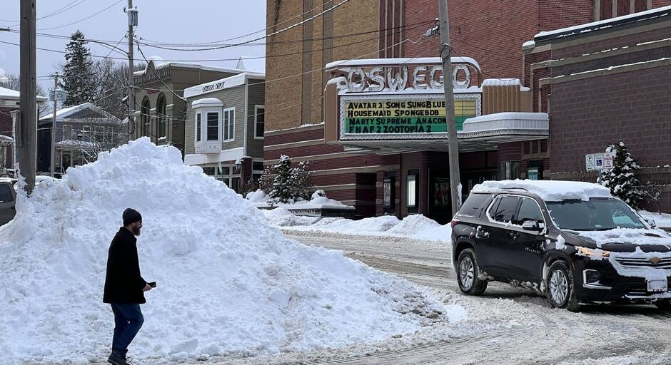
Snow piles stand feet high in Oswego during a lake-effect snowstorm.
(FOX Weather Correspondent Brandy Campbell / FOX Weather)
In Oswego County, just off Lake Ontario, heavy snow has blanketed the area since Thursday.
On Saturday morning, snow began to finally taper off.
HOW TO WATCH FOX WEATHER
Some light snow lingered southeast of the lakes into the morning, especially east of Lake Ontario.
-

A measuring stick shows 28 inches of snow in Fair Haven, New York on Jan. 2, 2026.
(Brandy Campbell) -

A snowy road in Oswego, NY on Jan. 2, 2026.
(Brandy Campbell) -

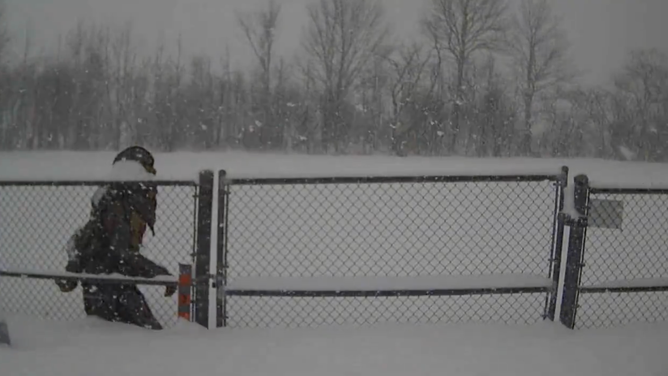
A person treks through feet of snow in Fair Haven, NY on Jan. 2, 2026.
(Brandy Campbell) -

Lake Ontario peeks in the background of photos from Oswego, NY.
(FOX Weather Correspondent Brandy Campbell) -

Plowed streets in Oswego on Jan. 2, after several inches of lake-effect snow.
(FOX Weather Correspondent Brandy Campbell) -
Intense snowfall rates of 5 inches per hour in Redfield, NY on Wednesday, Dec. 31, 2025.
(@NYSWRCC/X) -
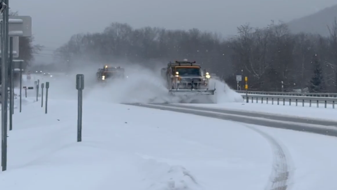
Plows hard at work in Cattaraugus County, New York, clearing snow from roads on Dec. 30, 2025.
(@NYSDOTBuffalo/X) -
Snowy scenes in Oswego, NY.
(Brandy Campbell)
As the day progresses, snow activity will continue to weaken through Saturday as winds become more west-to-east and the atmosphere becomes less favorable for lake-effect snow.
FOX Weather Correspondent Brandy Campbell reported live from Oswego, where roughly two feet of snow was recorded in 72 hours as of Saturday.
TOP WINTER STORM ESSENTIALS TO PREPARE: WHAT TO KEEP AT HOME TO STAY SAFE AND WARM BEFORE THE SNOW STARTS

Timelapse video from Thursday night into Friday showed lake-effect snow bands hitting the area, coating cars and creating low visibility.
Timelapse video from Thursday night into Friday showed lake-effect snow bands hitting the area, coating cars and creating low visibility.
Snow created dangerous travel conditions in the communities, as whiteout conditions and snow-covered roads made for a slow and treacherous commute.
WHAT IS LAKE-EFFECT SNOW?
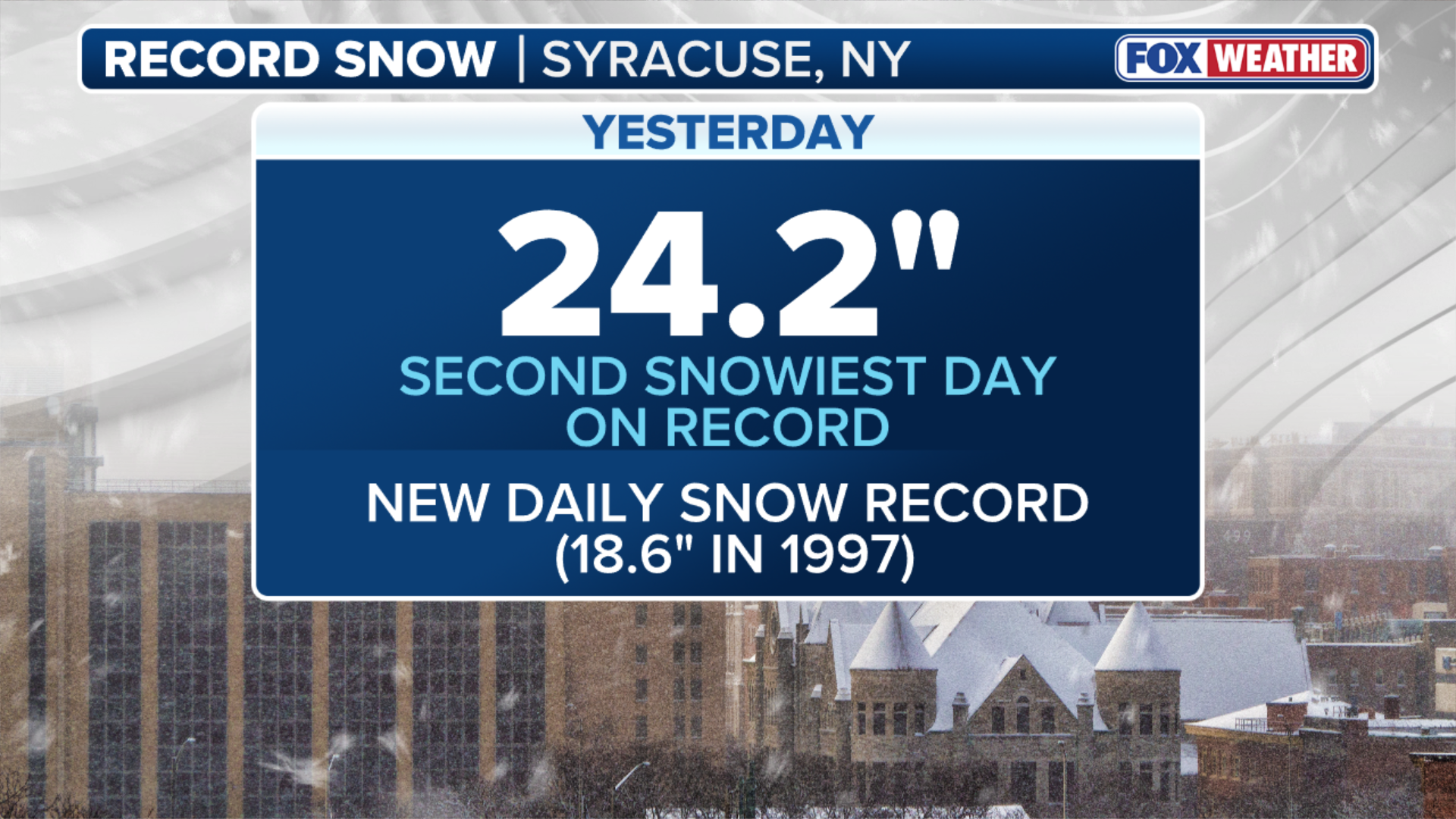
Lake-effect snow bands have rattled the Great Lakes for over a week, breaking records in places like Syracuse.
Syracuse, New York doubled its average snowfall record for the season, and saw more than two feet of snow on Tuesday alone.
(FOX Weather)
That marks the city’s second-snowiest day on record and their snowiest December day ever.
#Snowstorm #Weeklong #series #lakeeffect #bands #Great #Lakes #finally #ends

