‘Significant damage’ was reported in Central Wisconsin on Thursday during severe storms.
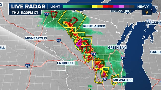
MINNEAPOLIS – Tornado Warnings wailed across Minneapolis and nearby communities on Thursday and tornadoes were spotted spinning through Minnesota and Wisconsin, as dangerous storms charged through the Midwest.
The severe weather was part of a weeklong event, with cities such as Minneapolis, Chicago and Milwaukee bracing for very large hail, hurricane-force wind gusts and tornadoes.
A thunderstorm with rotation prompted a Tornado Warning for the Minneapolis metro on Thursday afternoon, according to the National Weather Service.
Following the warning, there were no confirmed tornado touchdowns in the metro, with sightings outside of the Twin Cities.

(FOX Weather)
Significant damage reported in Central Wisconsin
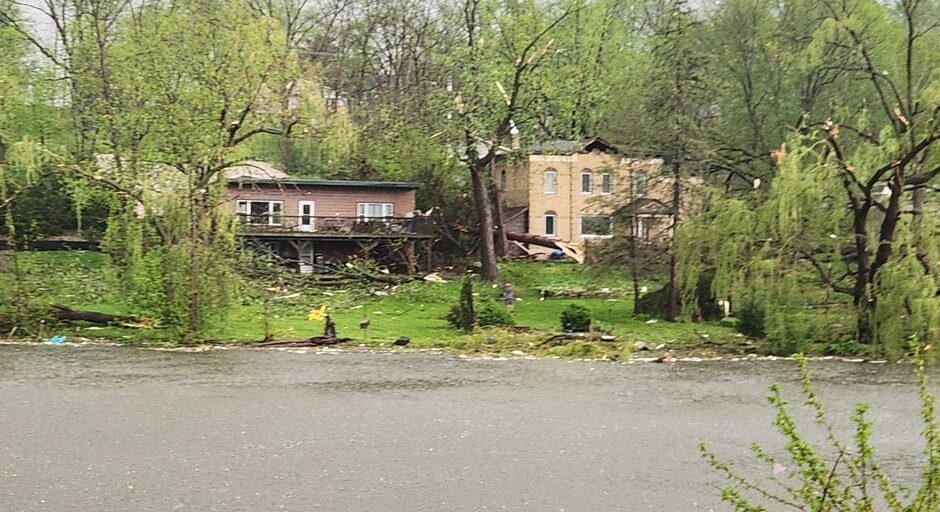
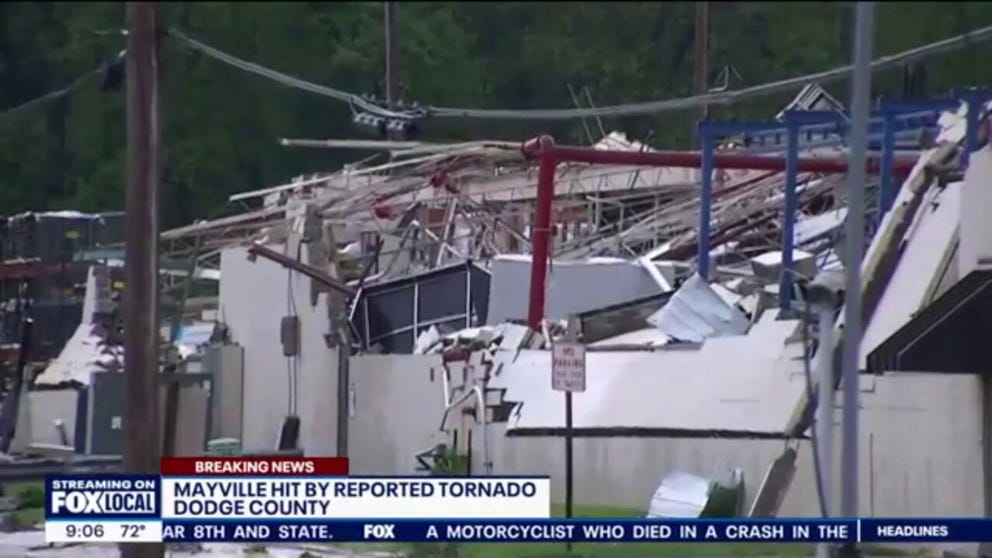
Significant damage was reported by first responders around Juneau and Mayville, Wisconsin, as a line of tornado-warned storms raced through on Thursday evening.
Emergency management encouraged residents to temporarily stay away from the area as crews attended to storm victims.
The local sheriff’s department reported multiple homes and businesses were damaged, with significant power outages in Dodge, Fond du Lac and Sheboygan counties.
Damage reported in Central Wisconsin from tornado-warned storms.
(FOX Weather)
Photos from around Juneau showed significant damage to farms, with trees and debris that blocked roadways.
The Mayville Fire Department reported responding to numerous gas leaks as well as buildings that had structural damage.
Emergency crews reported responding to numerous calls for injuries, but few people required transport to medical centers.
At least two shelters were opened for residents whose homes were significantly damaged during the severe weather event.
Officials said power outages could last for several days as many utility poles were snapped by the intense winds.
“Things can be replaced, but people can’t,” Dodge County Sheriff Dale Schmidt said during an evening news briefing.
A tornado around Mayville, Wisconsin, caused significant damage on Thursday.
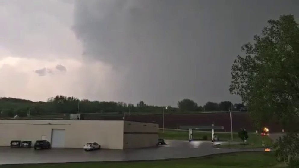
Tornadoes were also reported in New Richmond, Wisconsin, and Danvers, Minnesota, and appeared to be rope-like in appearance, according to storm spotters.
While there were no immediate damage reports from these twisters, the storms were just the first round of what is expected to be a couple of busy days across the region.
Most storm reports received by the Storm Prediction Center were from hail, which reached upwards of hen egg-sized in the Badger State.
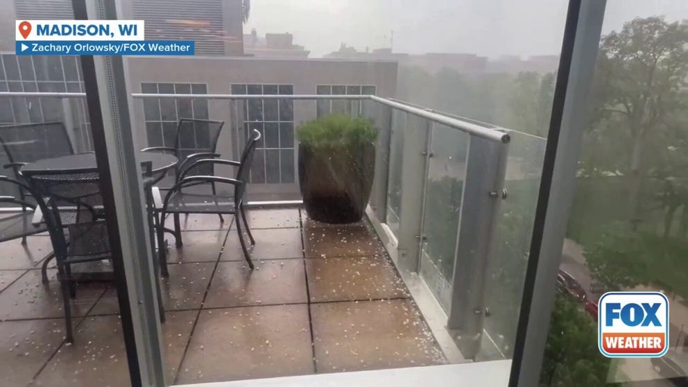
Storms dumped rain and hail on Madison, Wisconsin, on Thursday.
Video taken in downtown Madison, Wisconsin showed ice pelting balconies during the first round of storms.
In total, the SPC received nearly 400 reports of severe weather, with most coming from the states of Minnesota, Wisconsin and Illinois.
-

A potential tornado was spotted just south and east of New Richmond, Wisconsin, late Thursday afternoon.
(@mattmain13 / X) -

Ominous clouds over downtown Minneapolis on Thursday, May 15, 2025.
(@UnitedNathans/X) -

Ominous clouds over downtown Minneapolis on Thursday, May 15, 2025.
(@UnitedNathans/X) -
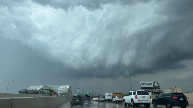
Storm clouds loom over Minnesota drivers on Thursday.
(@ZachHalverson / X) -

Tornado in New Richmond, Wisconsin
(Tara Olson via FOX 9 Minneapolis) -

Hail from East Troy in southeastern Wisconsin.
(@AmyM10113 / X) -

Tornado damage reported in Juneau, Wisconsin on May 15, 2025.
(Brian Jansen) -

Tornado damage reported in Juneau, Wisconsin on May 15, 2025.
(Brian Jansen) -

Tornado damage reported in Juneau, Wisconsin on May 15, 2025.
(Brian Jansen) -

Tornado damage reported in Juneau, Wisconsin on May 15, 2025.
(Brian Jansen) -

Tornado damage reported in Juneau, Wisconsin on May 15, 2025.
(Brian Jansen)
As a precautionary measure, a concert starring Beyoncé at Soldier Field in Chicago was pushed back from a 7 p.m. to a 9 p.m. start time in order to allow the worst of the weather to push through.
Shortly after 7 p.m. concertgoers received warnings from the local National Weather Service to seek shelter as severe storms with plenty of lightning and gusty winds moved through the Windy City.
Both Midway and O’Hare airports reported significant delays as a line of storms rumbled through the area.
HOW TO WATCH FOX WEATHER
Friday’s severe weather threat increases

(FOX Weather)
The severe weather threat is continuing to increase as we head into Friday, with more than 6 million people in cities like Bloomington, Indiana, St. Louis, and Louisville, Kentucky, and Clarksville, Tennessee, in a Level 4 out of 5 threat.
A lesser Level 3 out of 5 threat is in place for major cities, including Indianapolis, Nashville, Cincinnati and Knoxville.
Storms, however, could erupt across a wide swath of the U.S. from Texas to the Northeast.
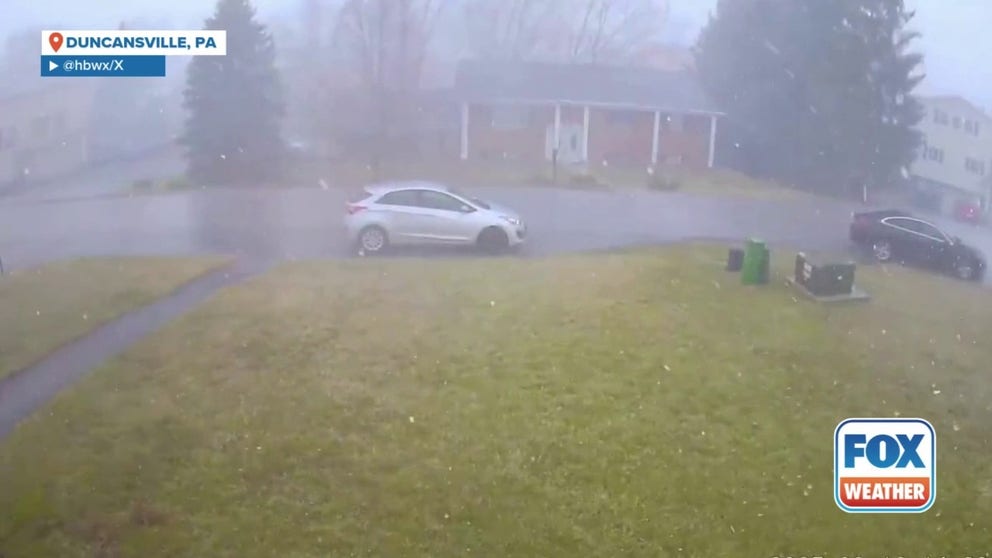
FILE VIDEO – Home security video shows a powerful squall moving through Duncansville, Pennsylvania on Sunday as a line of storms moves across the eastern U.S.
The SPC has placed more than 47 million people in a Level 2 out of 5 threat on Friday for cities like Dallas, Columbus in Ohio, Memphis, Philadelphia and Baltimore.
Tornadoes, large hail and damaging wind gusts are all possible with storms that develop on Friday.
Philadelphia, Washington at risk of severe storms on Saturday

(FOX Weather)
The multiday severe weather threat will continue on Saturday, and the threat zone includes tens of millions of people along the Interstate 95 corridor on the East Coast.
The SPC placed cities like Philadelphia, Baltimore and Washington in a Level 2 out of 5 threat on Saturday. An additional Level 2 threat is in place for areas of the Southern Plains and Arkansas, including the Dallas-Fort Worth Metroplex in Texas.
New York City and Boston will also be at risk of strong to severe storms, and those cities have been placed in a Level 1 threat. To the south, cities, including Memphis, Oklahoma City, and Atlanta also face this same level of threat.

FILE – A lightning bolt strikes between Lower Manhattan in New York City and Jersey City during an electrical storm on August 4, 2022, as seen from Hoboken, New Jersey.
(Gary Hershorn / Getty Images)
Long-range models show severe weather threat extending into next week
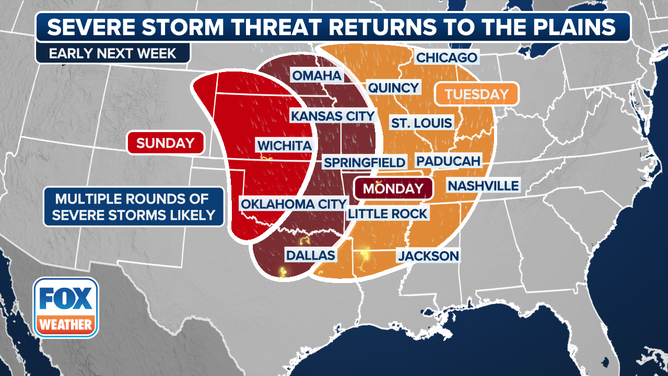
This graphic shows a severe weather threat starting on Sunday, May 18.
(FOX Weather)
Computer forecast models suggest the threat of severe weather could extend each day into at least the start of next week.
The FOX Forecast Center said an area of low pressure is expected to form near the Rockies by early Sunday. Storm energy will move into the southern Plains as a warm front lifts northward.
Storms are then expected to fire up east of the dryline – a boundary separating a humid air mass from a much drier air mass – by late Sunday.
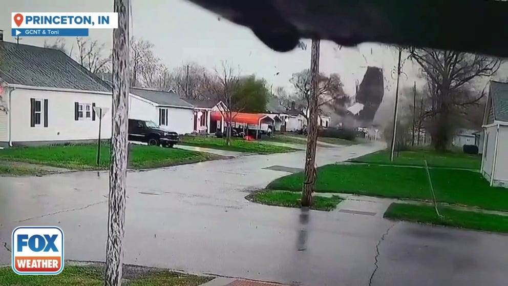
FILE VIDEO – Intense video captured an EF-1 tornado impacting Princeton, Indiana, on Thursday. The footage shows debris swirling through a residential area before the tornado tore the roof off a house. Multiple homes and Princeton Community High School sustained damage. Fortunately, no injuries were reported.
By Monday, a more widespread severe weather threat is expected as the system moves deeper into the Plains, with all severe weather hazards possible.
Then, by Tuesday, the FOX Forecast Center said the threat of severe weather could push eastward into the Ohio Valley. However, that’s still several days away, and details will be ironed out as more information is learned.
#Significant #tornado #damage #reported #Wisconsin #severe #storms #move #Great #Lakes