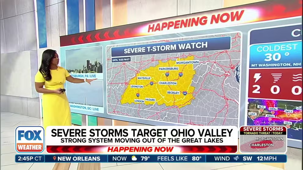
Strong storms moving out of the Great Lakes are targeting the Ohio Valley and parts of the Mid-Atlantic through Monday night. A Severe Thunderstorm Watch is in place for parts of Kentucky, Ohio, Pennsylvania, Virginia and West Virginia. FOX Weather Meteorologist Kiyana Lewis explains the storm energy fueling these weather threats early in the workweek.
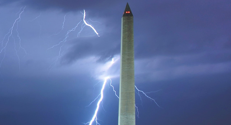
WASHINGTON – Millions of people from the Ohio Valley to the mid-Atlantic have started the workweek confronting severe weather as a fast-moving cold front plows across the region Monday.
Powerful storms dumped large hail across parts of Ohio and West Virginia on Monday afternoon. According to the National Weather Service, hail the size of hen eggs has been reported.
FOX Weather exclusive storm tracker Brandon Copic drove through so-called hail fog near Wheelersburg, Ohio, where he said “copious amounts of hail” had fallen. Hail fog usually forms after a heavy hailstorm. The balls of ice that have collected on the ground cool the air above them to the dew point, resulting in fog.
Where severe weather is happening right now
Cities across portions of Kentucky, Ohio, West Virginia, Pennsylvania, Virginia, Maryland and Washington, D.C., face the highest risk of powerful thunderstorms Monday.
HOW TO WATCH FOX WEATHER

(FOX Weather)
A Severe Thunderstorm Watch is in effect through Monday night for many of these areas, including central and eastern Kentucky, southern Ohio, southwestern Pennsylvania, southwestern Virginia and West Virginia.
DOWNLOAD THE FREE FOX WEATHER APP

(FOX Weather)
The main threats from thunderstorms that develop will be damaging wind gusts and large hail. However, some tornadoes are also possible. The thunderstorms could also produce life-threatening lightning and torrential rain.
Another severe weather threat looms by late-week

(FOX Weather)
The FOX Forecast Center said an active stretch of severe weather is expected to develop later this week as millions prepare to travel and celebrate Easter. However, forecasters said the most significant threats will likely be on Thursday and Friday.
On Thursday, conditions are expected to become favorable for severe thunderstorms across parts of the Plains and Midwest. The SPC said about 4 million people in cities like Omaha and Lincoln in Nebraska, as well as Des Moines, Cedar Rapids and Davenport in Iowa, will be at risk.
WATCH VS. WARNING: HERE ARE THE DIFFERENCES BETWEEN THESE WEATHER TERMS THAT COULD SAVE YOUR LIFE
The severe weather threat will then expand on Friday, stretching from Texas in the southern Plains to Detroit in the Great Lakes.
Any thunderstorms that develop on Thursday and Friday could produce damaging wind gusts, large hail and even some tornadoes.
#Severe #storms #threaten #millions #Cincinnati #Washington #Monday